The image of an almost untouched Amazon, occupied by small populations scattered mainly along the banks of major rivers, loses ground in the face of a new scale revealed by technology. In a landscape now covered by forest, pastures, and agricultural areas, researchers have found evidence of a society capable of building thousands of earthen monuments, organizing collective labor, and maintaining ceremonial and political centers for centuries.
The study, co-authored by an international team including Amazonian researchers, estimated between 24,000 and 30,000 earthworks in the area associated with the so-called Aquiry civilization, in the southwestern Amazon. The survey expanded the area attributed to this cultural complex to approximately 183,000 square kilometers, nearly three times the previously estimated extent.
It is the population figure that shifts the dimension of history, for between 100 and 300 CE, the Aquiry may have brought together 1.25 million to 3 million people. Considering the limitations imposed by the forest on the detection of structures, the study acknowledges that this population may have reached an even higher range, from 1.6 million to 3.8 million. Therefore, these are not merely ancient drawings viewed from above. What emerges now is the outline of an entire society.
STRUCTURES
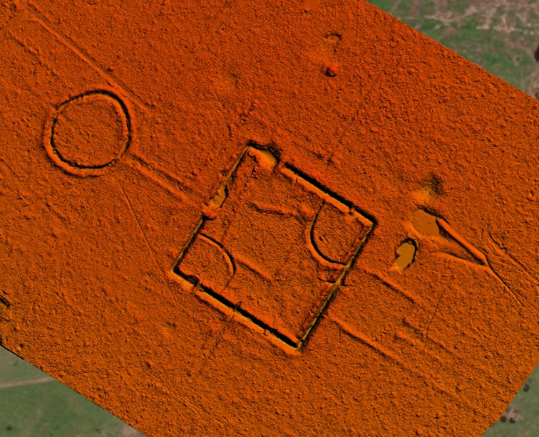
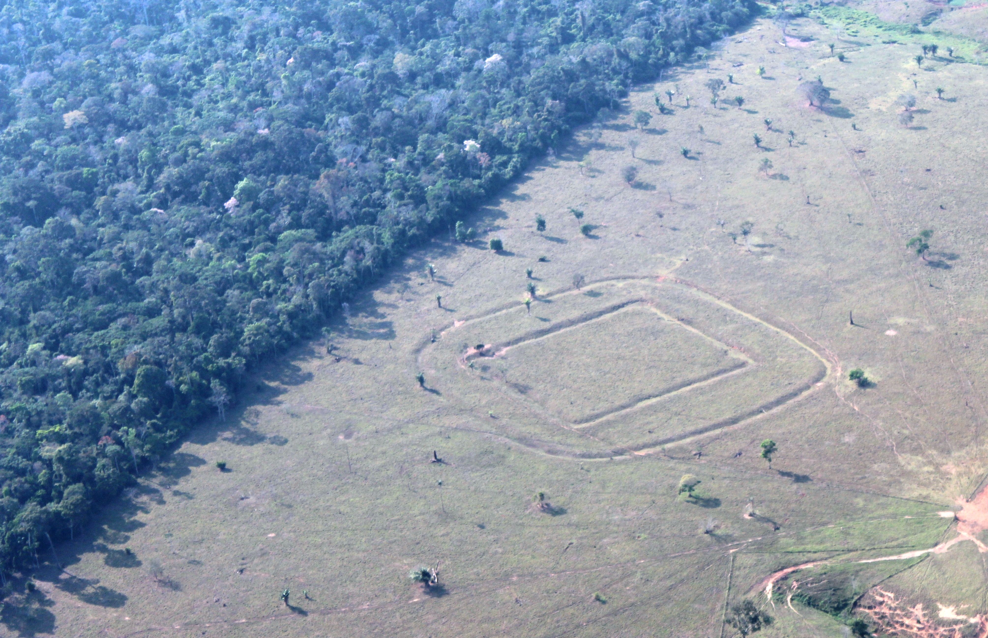
Geoglyphs are large structures built through earthmoving. Ditches, embankments, paths, and geometric shapes transformed the relief to create circles, squares, and polygons on a monumental scale. According to the study, construction on these structures began between approximately 600 BCE and 850 CE, although different types of works were built in later periods. Some of the largest known geoglyphs approach 50 hectares (or about 70 soccer fields), and the ditches can reach up to five meters in depth.
It is an architecture that was not made to remain standing. It survived in the ground. 'Geoglyph, geo, earth; glyph, marks. Huge marks in the soil of the Amazon,' explains Dr. Alceu Ranzi, geographer, paleontologist, and president of the Amazon Geoglyphs Institute.
Ranzi has known this landscape since before it acquired the name by which it is recognized today. In the 1970s, still a geography student, he participated in fieldwork associated with the National Program for Archaeological Research in the Amazon Basin (Pronapaba). Years later, during a commercial flight to Acre, he encountered those geometric shapes once again. 'A circle in the soil. And I was very fortunate to make a mental map of the flight,' he recalls.
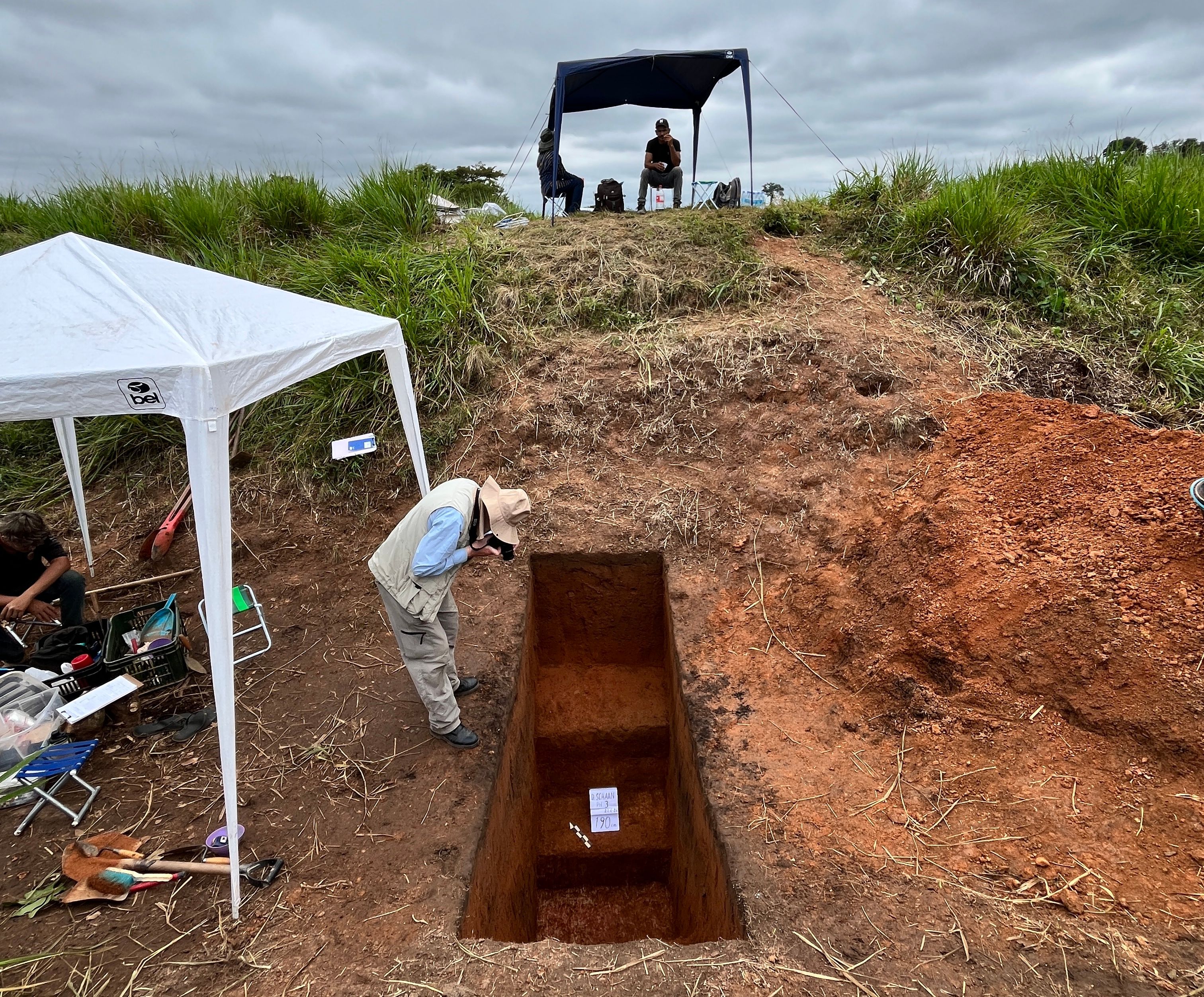
The observation led to new overflights, aerial photographs, and the resumption of an investigation that would gain momentum from the 2000s onward. It was during this process that archaeologist Denise Schaan, from the Emílio Goeldi Museum (MPEG) from Pará, came to occupy a central role in the research. She was one of the main figures responsible for deepening the archaeological interpretation of Acre's geoglyphs and for formulating the hypothesis that these structures served a strong ceremonial function.
Laser can see beneath trees
For decades, the identification of geoglyphs was limited primarily to already deforested areas, where the shapes could be perceived through aerial photographs or satellite imagery. The forest hid much of the past.
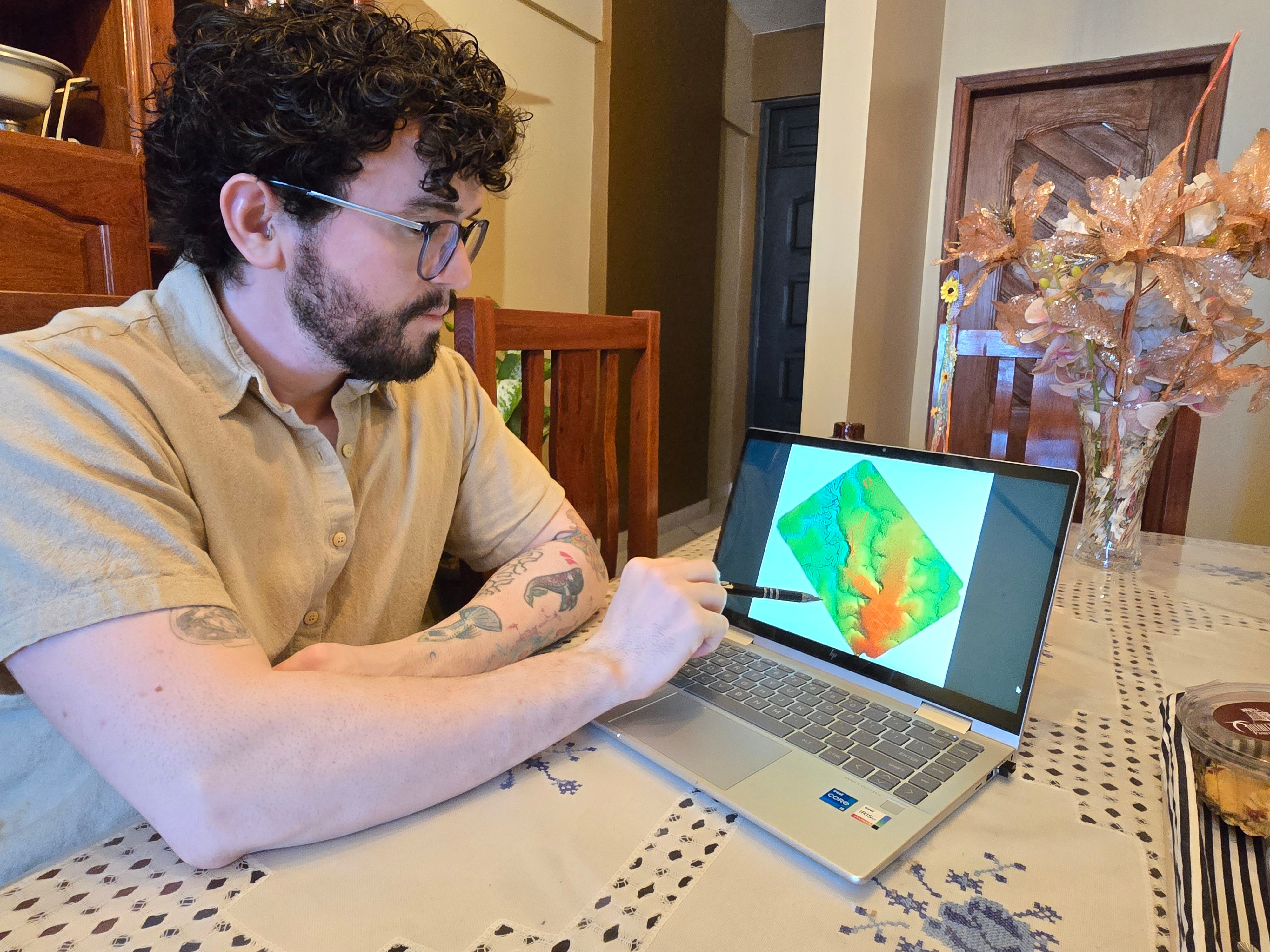
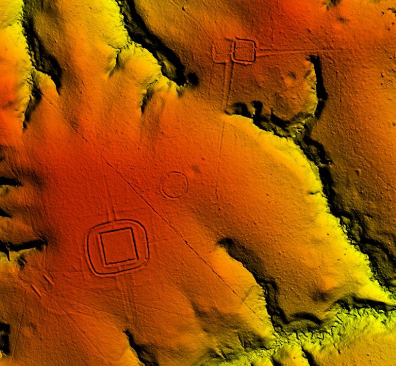
The Nature study used LiDAR technology, a laser scanning system installed on aircraft or drones, capable of recording terrain topography even beneath the forest canopy. In 2024, 4,430 kilometers of flights were conducted over the states of Acre and Amazonas. The research identified 432 structures, of which only 36 were previously known. 'LiDAR is a fantastic technology. It literally can see beneath trees,' explains Rhuan Carlos Lopes, a professor at the Federal University of Pará (UFPA) and one of the study's coordinators.
The difference compared to satellite imagery was striking. In one of the compared areas, LiDAR found 156 structures where only 30 had previously been recognized. The result does not mean that exactly 30,000 geoglyphs have already been located. The number is a scientific projection built from systematically scanned areas, previous surveys, and estimates for regions where vegetation cover prevents complete visualization and that have not yet been surveyed. The team emphasizes that part of the structures remains invisible to the laser.
ESTIMATES
The result broadens a shift that had already been building within Amazonian archaeology. Until the early 2000s, it was still common to imagine that large pre-colonial population concentrations were restricted to floodplains and riverbanks. The terra firme(interfluvial hinterland) areas, which account for more than 90 percent of the Amazon, were viewed as less favorable to occupation by dense populations. The geoglyphs themselves helped dismantle this hypothesis. 'It was not imagined that the upper rivers, the terra firme, between the major rivers, had also been occupied,' states Alceu Ranzi.
Today, estimates for the entire pre-Columbian Amazon are already much higher than old projections. The study itself notes that population estimates for the so-called Greater Amazon rose from about 1.5 million to 2 million inhabitants to a range of 5 million to 10 million.
The new study proposes that this population was not simply gathered in large cities in the modern mold. Researchers speak of 'forest urbanism' or low-density urbanism, which is when you have a landscape composed of scattered communities, connected by paths and organized around ceremonial, political, and social centers.
'They were not millions of people grouped in a single place. They lived in a type of urbanity; it was another way of living in the Amazon,' explains Dr. Rhuan.
How geoglyphs were built
Building a geoglyph required more than physical strength. It was necessary to understand the terrain, plan the geometry, move large quantities of soil, organize workers, and maintain the structures across generations. For the study's authors, this presupposes a division of labor, mathematical and geometric knowledge, and an administrative organization capable of coordinating activities over centuries.
Ranzi sees in these signs a sophisticated demonstration of knowledge. 'They were mathematicians, they were engineers, they were architects, in our concept,' he states. Some geoglyphs form larger complexes, with multiple associated structures. Others are connected by straight roads.
The research indicates that many of these spaces functioned as public, ceremonial, and political centers, used for gatherings of diverse groups, without permanent occupation and without characteristics of defensive fortifications.
Rhuan also draws attention to another important shift in reading the indigenous past. 'I do not like to talk about discovery, because that is very much a colonizing perspective,' he states. For him, the structures are not new to the indigenous peoples who descend from those groups. What is new is our contemporary ability to recognize, map, and interpret them on a scale that was previously impossible.
CULTIVATIONS
Geoglyphs also help shift the discussion on what constitutes a 'natural forest.' Researchers found evidence of maize and squash cultivation and point to the likely use of manioc, sweet potato, peppers, beans, and peanuts. Trees such as Brazil nut, bacaba, peach palm, and other palms also appear associated with the region's history of human management.
The study states that the Aquiry communities acted as managers of land, water, and forest gardens. Periodic fires in bamboo-dominated areas may have contributed to maintaining soil fertility and helped create conditions for the emergence of complex societies. The forest that today looks completely wild also carries a memory of very ancient human intervention. Not necessarily an intervention of destruction, but of management, circulation, cultivation, ritual, and organization.
'So, generating part of the fruits and plant species that we know and use to this day here in the Amazon. We are the result of a very deep, very well-articulated historical trajectory, a producer of technology, a producer of diversity,' observes Rhuan.
A history prior to Brazil
The geoglyphs began to be built around 600 years before Christ and remained in use for centuries. The period of highest estimated population concentration occurred between the years 100 and 300 of the Christian Era. It is a chronology that helps gauge what is at stake.
While other parts of the world were recording their own civilizations, Amazonian communities were already moving large volumes of earth to create monumental geometric forms, establish ceremonial centers, and articulate a landscape that has remained, almost invisibly, up to the present day. Ranzi sees in this long permanence a lesson that goes beyond archaeology. 'We have room to preserve heritage, for national parks, for indigenous lands, for the development of livestock farming, the development of agriculture. We must know how to live in harmony,' he states.
The lingering question is not just how many geoglyphs are still hidden. It is how many stories remain beneath the forest, in other words, the research placed at the center of the discussion the possibility that millions of people lived, worked, celebrated, and transformed the Amazonian landscape nearly two thousand years ago.
The project was coordinated by the Ibero-American Institute of Finland, with general direction by Finnish archaeologist Martti Pärssinen from the University of Helsinki, and Brazilian direction by UFPA professor Rhuan Carlos Lopes, in partnership with Danish and Brazilian universities.
The full article can be freely accessed through the link:
https://www.nature.com/articles/s41586-026-10835-7
INSTITUTIONAL PARTNERSHIP
The production of Liberal Amazon is one of the initiatives of the Technical Cooperation Agreement between the Liberal Group and the Federal University of Pará. The articles involving research from UFPA are revised by professionals from the academy. The translation of the content is also provided by the agreement, through the research project ET-Multi: Translation Studies: multifaces and multisemiotics.